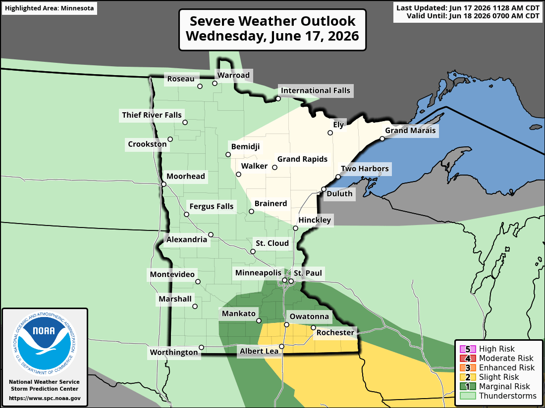
A severe weather threat exists across southeastern Minnesota Wednesday afternoon and evening as our next disturbance moves through the Upper Midwest.
Severe weather threat develops
The latest analysis shows a surface low tracking across southern Minnesota, bringing the threat for some strong to severe storms Wednesday afternoon into the evening hours.

Areas that see breaks of sunshine Wednesday afternoon will have the greatest potential for strong to severe thunderstorm development. The main threats include large hail, damaging wind gusts and the possibility of a few tornadoes.
Any storm will also be capable of producing brief downpours, frequent lightning, and locally heavy rainfall.

The National Oceanic and Atmospheric Administration Storm Prediction Center has placed southeastern Minnesota under a slight risk for severe thunderstorms Wednesday afternoon and evening, including the communities of Albert Lea, Austin, Faribault and Rochester.

The highest chance for severe weather will be from midafternoon through early evening Wednesday with storms potentially developing and strengthening quickly during that time.

Collected from Minnesota Public Radio News. View original source here.
 Minnesota Public Radio (MPR) is a public radio network for the US state of Minnesota. With its three services, MPR News, YourClassical MPR and The Current, MPR operates a 46-station regional radio network in the upper Midwest.
Last updated from
Minnesota Public Radio (MPR) is a public radio network for the US state of Minnesota. With its three services, MPR News, YourClassical MPR and The Current, MPR operates a 46-station regional radio network in the upper Midwest.
Last updated from